Lake Bolsena | Lago di Bolsena
|
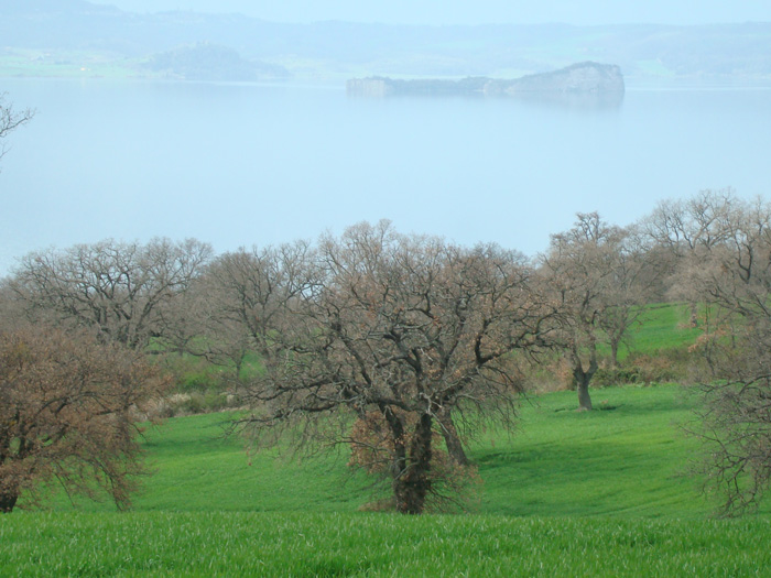
| Everyone has heard of Lake Como and Lake Maggiore, but few know about the beautiful lake and historic region that lies in the heart of Italy, not far from the popular Tuscan and Umbrian tourist spots and it remains one of Italy's best kept secrets. Located on the borders of Tuscany and Lazio, the lake is formed in the crater of an extinct volcano. The waters are crystal clear and teem with fish, and are ringed with crescents of fine volcanic sandy beaches. The capital of the Lake is Bolsena itself. Once the Etruscan settlement of Volsini and medieval town of miracles, it is famous for its gardens and annual flower festival. Lake Bolsena (Italian: Lago di Bolsena) is a crater lake of central Italy, of volcanic origin, which was formed starting 370,000 years ago following the collapse of a caldera of the Vulsini volcanic complex into a deep aquifer. Roman historic records indicate activity of the Vulsini volcano occurred as recently as 104 BC, since when it has been dormant. The two islands in the southern part of the lake were formed by underwater eruptions following the initial collapse of the caldera. The lake is supplied entirely from the aquifer, rainfall and runoff, with one outlet at the southern end. A sewage treatment plant filters most of the raw sewage from the surrounding communities. Constructed in 1996, it features pipelines transporting the sewage from every major community around the lake to the treatment plant on the Marta River; that is, no effluents enter the lake.[4] Fertilizers are a second source of contamination. However, the chemical content of the lake is monitored at several stations around it. Lying within the northern part of the province of Viterbo that is called Alto Lazio ("Upper Latium") or Tuscia, the lake has a long historic tradition. The Romans called it Lacus Volsinii, adapting the Etruscan name, Velzna, of the last Etruscan city to hold out against Rome, which was translocated after 264 BC, and its original location today has not been securely identified. The lake is bordered on one side by updated forms of the Roman consular road Via Cassia. In addition to the historic sites of all periods, Lake Bolsena is currently surrounded by numerous tourist establishments, largely for camping, agrotourism and bed and breakfasts. One third of the lake was donated to the Church by the noble family Alberici of Orvieto. In recognition of the donation the Alberici family was honored with a ceremony three times a year performed by the Bishop of Orvieto. |
Geography |
| Islands of the lake With an area of 17 ha (42 acres), Bisentina is the largest island, and is accessible via a ferry service from Capodimonte. On the island are groves of evergreen oaks, Italian gardens, and various monuments: the church of Saint James and Saint Christopher with its cupola built by the architect Jacopo Barozzi da Vignola; the Franciscan convent; the Rocchina, a small temple dedicated to Saint Catherine. The latter was constructed in an octagonal floorplan by Antonio da Sangallo, over an Etruscan colombarium previously erected on a rocky outcrop on the lake. Another monument, the chapel of the Crucifix, contains frescos of the fifth century. The Malta dei Papi, a former prison for ecclesiastics found guilty of heresy, was shaped from a small cave with a trapdoor placed at a height of 20 m (66 ft). The Etruscans and the Romans left few traces of their stay on the island. In the 9th century it provided refuge from the incursions of the Saracens. About 1250, it became the property of the lord of Bisenzio, who abandoned it and burned it following disagreements with the inhabitants of the island. In 1261, Urban IV reconquered it. The island was destroyed again in 1333 by Louis IV of Bavaria, accused of heresy and excommunicated by the pope. The property of the Farnese family from 1400 onwards, it had a period of prosperity and was visited by many popes. In 1635, it was governed by Odoardo Farnese, duke of Castro, who entered into conflict with the Church, resulting in the total destruction of Castro. The two islands returned to the Church's control but were soon ceded again. The princess Beatrice Spada Potenziani, wife of the duke Fieschi Ravaschieri, is the current owner. Isola Martana Located opposite the town of Marta, the island of Martana is reputed to have once guarded the relics of Saint Christine to keep them from falling into the hands of the barbarians. Later, it is said that, during the dominion of the Goths, the Gothic queen Amalasuntha was assassinated there. The island is currently private property and no visitors are permitted. |
| The emissary Marta, which leaves Lake Bolsena to the east of the community of Marta, is a river emptying into the Tyrrhenian Sea. After passing through Marta, Tuscania and Tarquinia, it reaches the sea in the area of the lido of Tarquinia. There between the mouth of Marta and that of Mignone was created the natural reservoir "Saltworks of Tarquinia". |
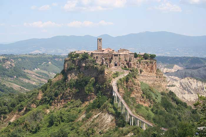 |
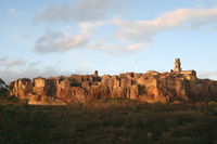
Civita di Bagnoregio |
| Comuni bordering the lake The following comuni are situated on the shore of Lake Bolsena: * Bolsena Each has a designated length of beach for summer swimming. Some of these have facilities such as cafes, restaurants and boat hire. Other nearby towns are Sorano, Pitigliano, Acquapendente and Orvieto, with Onano to the northwest. |
||||
|
||||
 |
 |
 |
||
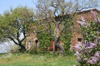
Podere Santa Pia |
Podere Santa Pia |
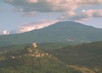
Rocca di Tentennano |
||
 |
 |
 |
||
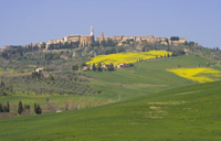
Pienza |
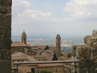
Montalcino |
San Quirico d'Orcia |
||
 |
 |
 |
||
Pitigliano |
Sorano |
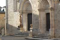
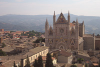
Orvieto, Duomo |
||
Civita di Bagnoregio was founded by Etruscans over twenty-five hundred years ago, but has seen its population dwindle to just fifteen residents over the course of the 20th century. Cività was the birthplace of Saint Bonaventure, who died in 1274. The location of his boyhood house has long since fallen off the edge of the cliff. By the 16th century Civita was beginning to decline, becoming eclipsed by its former suburb Bagnoregio. |
||||
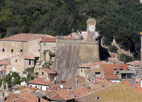
Walking in Tuscany | Sorano and the rock settlement of Vitozza Coming from the direction of Sovana, two kilometres from the village of Sorano, we meet the well-marked sign to the necropolis of San Rocco and its church. We cross the bridge that brings us to the indicated area, where we can admire the necropolis and the splendid balcony that looks over the village and, right behind the church, we descend the via cava di San Rocco, that leads to the bottom of the valley below Sorano. |
 Vitozza La Chiesaccia Vitozza La Chiesaccia |
|||
| This page uses material from the Wikipedia article Lake Bolsena and Civita di Bagnoregio, published under the GNU Free Documentation License. Wikimedia Commons has media related to: Lake Bolsena. |
||||