Guida Toscana, Immagini della Toscana


Albarese
| Parco Naturale delle Maremma

Capalbio


Colline Metallifere


la costa Toscana

Crete Senesi

         
Abbazia di Monte Oliveto Maggiore

Grosseto


Manciano


Montagnola Senese

         Walking in the Montagnola senese


Montalcino

Monte Amiata

Montepulciano

Prato

Scansano

Siena

          Fonti di Siena

Sorano

Sovana

Val d'Elsa

Val d'orcia

          Montalcino

          Pienza

          Sant'Antimo

          San Quirico d'Orcia

          Radicofani

          Walking in the Val d'Orcia


Val di Chiana

         Montepulciano

         Montefollonico


Valle d'Ombrone


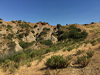
Castiglioncello Bandini, Calanchi in the valleybeween Podere Santa Pia, Federano and the torrent Rancida

Calanchi in the valleybeween Podere Santa Pia, Federano and the torrent Rancida [1]

Toacana ] Galleria di immagini  


Calanchi in the valley beween Podere Santa Pia, Federano and the torrent Rancida


Calanchi in the valley below Santa Pia

[1]


Mappa Castiglioncello Bandini| Ingrandire mappa


Album Sovana, Sovana Photo Gallery

Castiglioncello Bandini album


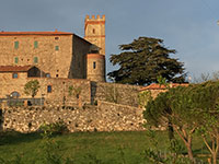
Castiglioncello Bandini, castello   Castiglioncello Bandini, Calanchi in the valleybeween Podere Santa Pia, Federano and the torrent Rancida  

Castiglioncello Bandini, castello


Castiglioncello Bandini, Calanchi in the valleybeween Podere Santa Pia, Federano and the torrent Rancida

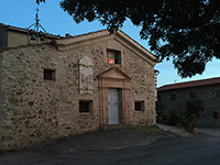
  Castiglioncello Bandini


Walking in southern Tuscany | Itineraries exploring Castiglioncello Bandini and the Mediterranean macchia in the valleys around the village

Brief itinerary exploring the Mediterranean macchia and calanchi in the valley between Podere Santa Pia and Cinigiano

Circular Trail | Starting Point, the cypresses of Podere Santa Pia

Lenghth: 3,85 km, 1 hour 20 minutes

Easy, except for the track halfway

Through the woods to Castiglioncello Bandini

Starting Point, the cypresses of Podere Santa Pia or the Castle of Castiglioncello Bandini

Lenghth: 6 km, 1 hour 55 minutes

Easy | 227 m upwards, 227 m downwards

From Podere Santa Pia (Castiglioncello Bandini) to Cinigiano

Lenghth: 8,34 km

Easy

Hiking along the Rancioa riverbed, in the hidden valleys below Castiglioncello Bandini

Circular Trail | Starting Point, the cypresses of Podere Santa Pia

Lenghth: 4,42 km, 1 hour 31 minutes

Easy, except for the essential part of the track beyond Podere Federano, where you reach and follow the Rancioa riverbed


[1] Photo Rein Ergo